
Magical crossing of Les 3 Vallées: 6 days of adventure in the heart of the French Alps
- 6 Days
- June to October
6-Day Trek in Les 3 VallÉes in the French Alps: Between Tents and MOUNTAIN refuges
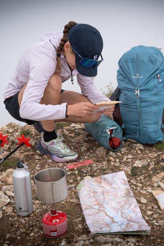
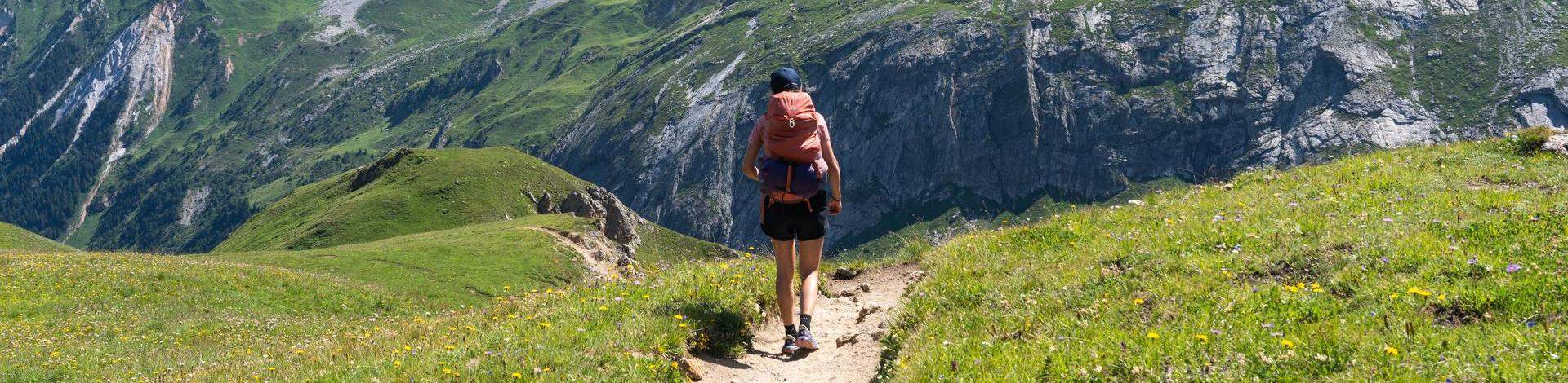
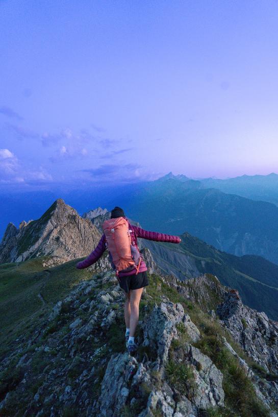
Dive into an unforgettable adventure with our community manager who embarked on a 6-day trek through the splendid 3 Vallées in the French Alps. From the grand alpine landscapes to the peaceful nights spent in tents or welcoming mountain lodges, this unique experience highlights the majesty and diversity of our region. Be captivated by breathtaking panoramas, authentic encounters, and moments of pure discovery, showcasing the boundless possibilities at the heart of the French Alps.
Explore a detailed overview of the itinerary, highlighting key points for an unforgettable experience.
DAY 1: REFUGE LE REPOJU → REFUGE DES LACS MERLET
Itinerary
Departure: Refuge le Repoju in Pralognan-la-Vanoise (alternative possible from Courchevel), heading towards Petit Mont Blanc.
Col du Mône: First pass crossed for breathtaking views.
Petit Mont Blanc: Enjoy the spectacular view from the summit
Descent: Via the Col des Saulces, offering stunning panoramas.
Vallée des Avals: Reach this picturesque valley.
Refuge du Grand Plan: Well-deserved rest at this peaceful haven.
Lacs Merlets: Arrival at the beautiful lakes for a bivouac near Refuge du Lac Merlet.
Key numbers
Distance: 15 km
Elevation Gain: 1300 m
Duration: 3 to 4 hours
Practical Information
Regulations: In the Vanoise National Park, it is mandatory to bivouac near a refuge and to book in advance.
Dogs Prohibited: Dogs are not allowed in the park.
-
Laïla Franchini, Community Manager of Les 3 Vallées Start your adventure from the Prioux parking lot for a breathtaking view of the surrounding valleys. For the more adventurous, the departure from Courchevel via Les Avals to Petit Mont Blanc offers a unique experience.
-
Laïla Franchini, Community Manager of Les 3 Vallées On the way down from Petit Mont Blanc, take the time to stop at Lac Blanc, where you can observe families of marmots in their natural habitat. A magical moment not to be missed!
DAY 2: MERLETS LAKES REFUGE -> THE CREUX NOIRS
Itinerary
Departure: Refuge des Lacs Merlets.
Cool Detour: Upper Lacs Merlets.
Ascent: Into the heights of the Avals Valley.
Col de Chanrossa: Reach this panoramic point.
Chanrossa Trail: Continue along this trail near the stream.
Lac des Creux: Break by the lake with a view of the Aiguille du Fruit.
La Saulire: Climb this summit.
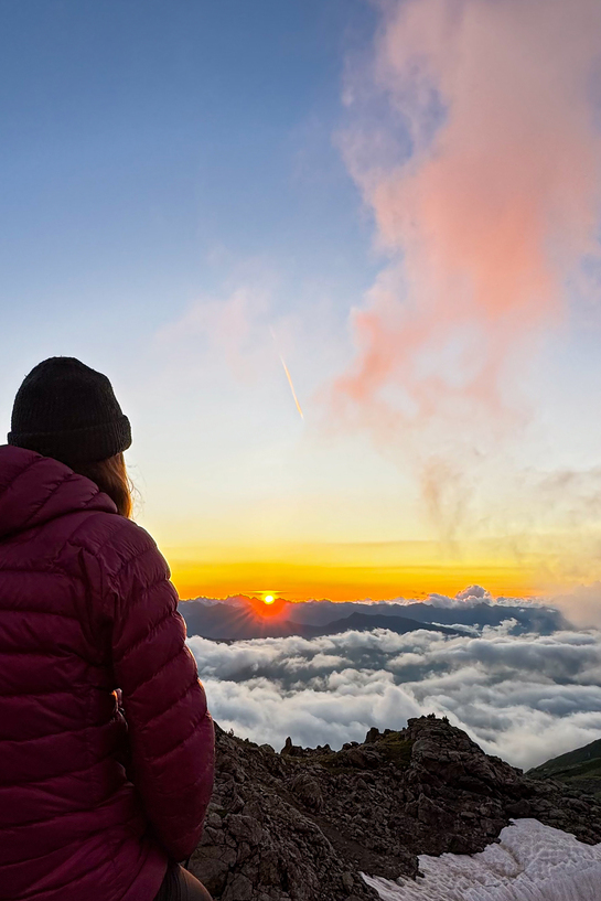
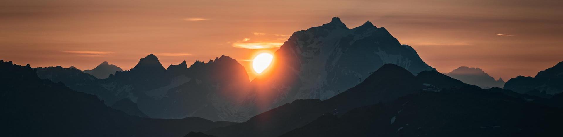
Les Creux Noirs: Set up our tent for a bivouac above the clouds with a magical sunset.
Key Numbers
Distance: 15km
Elevation Gain: Approximately 1000m
Estimated Time: 3 hours
Spending the night above the clouds, with a sunset that sets the horizon ablaze... an awe-inspiring atmosphere.
-
Laïla Franchini, Community Manager of Les 3 Vallées Take your time to explore the Lacs Merlet, especially Lac Merlet Supérieur with its crystal-clear water that invites contemplation.
-
Laïla Franchini, Community Manager of Les 3 Vallées For those wishing to shorten the distance a little, stay on the Creux trail to reach the Creux Noirs more quickly.
-
Laïla Franchini, Community Manager of Les 3 Vallées As you climb up to Col de Chanrossa, admire the breathtaking panorama of Mont Blanc and Grande Casse. A natural spectacle that will take your breath away!
-
Laïla Franchini, Community Manager of Les 3 Vallées Refresh yourself along the way by stopping off at the streams and Lac des Creux. There's no better way to invigorate yourself on this hike.
DAY 3: THE CREUX NOIRS -> BORGNE LAKES
Itinerary
Start: Les Creux Noirs
Passage: Col du fruit
Descent: Near the Vallon stream
Blueberry pie break: At the Refuge du Plan
Refreshment break: Near Plan de Tuéda
Red Mulberry: Towards Plan des Mains
Plan des Mains: Towards Mont Vallon
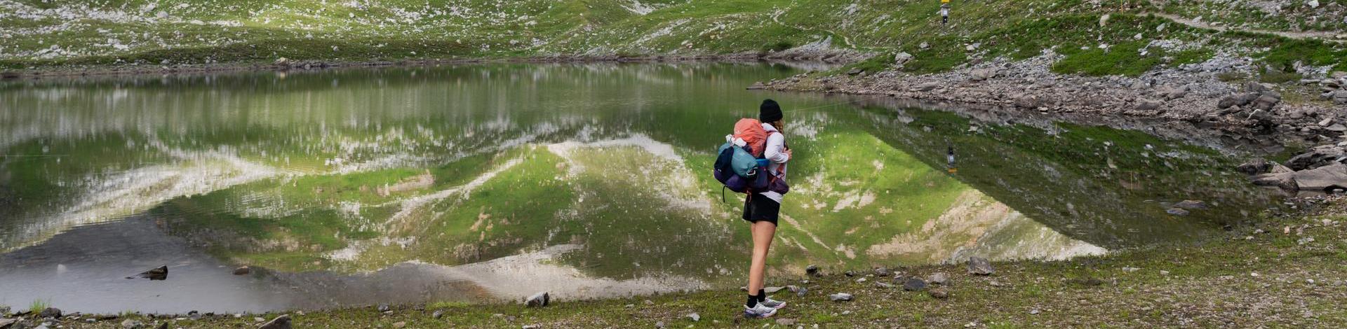
Borgnes Lakes: At the foot of the glacier, enjoy the reflection of the lake and the end-of-day lights as you pitch your tent for another evening in Les 3 Vallées.
Key Numbers
Distance: 13 km
Ascent: 1000 m
Time: 4 hours
Practical Information
- For lunch, the Refuge du Plan is the ideal place to recharge your batteries and enjoy the magnificent views.
- Take advantage of the many watering holes and the Vallon stream to refresh yourself. These little havens of peace are perfect for a well-deserved break.
-
Laïla Franchini, Community Manager of Les 3 Vallées The Col du Fruit pass offers spectacular views, marking the entrance to the Tueda nature reserve. A place to take your breath away!
-
Laïla Franchini, Community Manager of Les 3 Vallées Don't miss the mirror effect of the Lacs du Borgne at the foot of the glacier. The reflection of the mountains in these clear waters is a spectacle in itself.
DAY 4: BORGNE LAKES -> POINTE DE LA MASSE
Itinerary
Departure: The Borgne Lakes in the early morning
Passage: via Col du Borgne glacier
Chambre lake: Discover this alpine lake
Mont de la Chambre: breathtaking view of Mont-Blanc
Direction: Val Thorens
Lou Lake: Break by the lake
Gourmet break: At the Lac du Lou hut
Rond Lake: Next stop on the trail
Pointe de la Masse: A magical sunset
Wake-up call: Sunrise over Grande Casse
Chiffres clés
Distance: 20 km
Elevation Gain: 1400 m
Duration: 6 hours
-
Laïla Franchini, Community Manager of Les 3 Vallées For an unforgettable night, pitch your tent near Lac de la Montagnette for greater comfort, or at altitude to admire a breathtaking sunset.
-
Laïla Franchini, Community Manager of Les 3 Vallées Stop off at Lac de la Chambre for a well-deserved break. The setting is perfect for recharging your batteries.
DAY 5: POINTE DE LA MASSE -> GRAND PERRON DES ENCOMBRES
Itinerary
Departure: Pointe de la Masse
- Lac de la Montagnette: Take a break by the lake, where the peaks of Les Encombres reflect beautifully on the water.
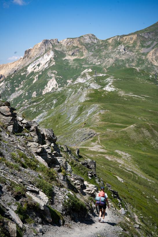
- Passage: Cross the Col des Encombres with breathtaking views of the Orelle and Maurienne summits.
- Le Perronnet: Traverse the combe.
- Le Petit Perron: A plateau perfect for setting up your tent.
- Le Grand Perron des Encombres: A prominent summit visible from the Maurienne Valley. It towers over the entire Encombres area and offers stunning views of the major peaks of Vanoise, Écrins, and the Aiguilles d'Arves.
Key Numbers
- Distance: 10 km
- Elevation Gain: 800 m
- Duration: 4 hours
Practical Information
For a peaceful night, pitch your tent on a grassy area sheltered from the wind, just before the final ridge. It's an ideal spot to rest.
-
Laïla Franchini, Community Manager of Les 3 Vallées On your way to the Grand Perron des Encombres, enjoy a breathtaking view of the Orelle peaks. A panorama well worth the detour!
-
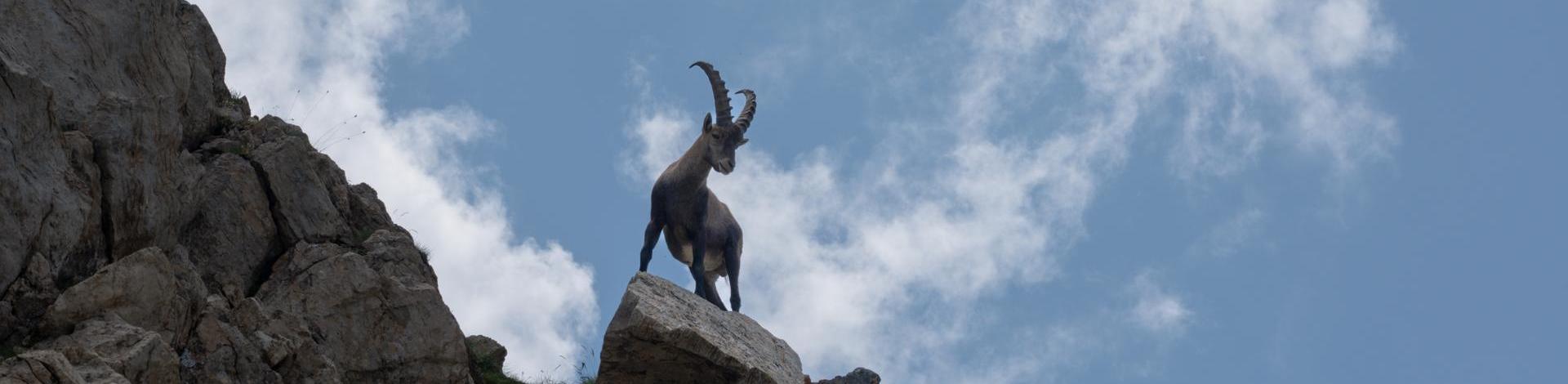
Laïla Franchini, Community Manager of Les 3 Vallées From July to August, keep your eyes peeled for ibex on the heights of Grand Perron. An unforgettable encounter with the local fauna.
DAY 6: GRAND PERRON DES ENCOMBRES -> SAINT-MARTIN-DE-BELLEVILLE
Itinerary:
Departure: Grand Perron des Encombres
Petit Perron: Pass through this plateau
Direction: Head towards the Encombres Valley
Caseblanche: Descend towards this hamlet
Gittamelon: Take a lunch break at the Gittamelon refuge
Les Priots: Cross through this village
Le Châtelard: Pass through this charming village
Saint-Martin-de-Belleville: Final destination of this stage
Key Figures:
Distance: 19 km
Elevation Loss: 1600 m
Duration: 5 hours
On the way back, stop off at the Refuge de Gittamelon for a delicious crêpe. A well-deserved treat to round off this adventure in style.
After a break in a refuge...
OUR TIPS FOR AN UNFORGETTABLE TREK IN THE FRENCH ALPS
Equipment to Bring
Hiking Boots: Choose sturdy, well-fitted hiking boots to avoid blisters and discomfort.
Technical Clothing: Opt for lightweight, breathable, and quick-drying clothing. Pack layers to adapt to temperature changes.
Backpack: Use a comfortable backpack with a suitable capacity (around 40-50L) to carry the essentials.
Sleeping Gear: Bring a season-appropriate sleeping bag and a lightweight tent if you plan to camp.
Food and Hydration: Take light meals, energy snacks, and a water bottle or filtration system.
Safety Gear: Don’t forget a first aid kit, a headlamp with spare batteries, and a map/guidebook.
Weather Tips
Anticipation: Check weather forecasts regularly before and during your trek to adapt your route accordingly.
Adaptability: Be ready to change your route or stop if bad weather conditions arise.
Protection: Bring a waterproof and windproof jacket, as well as a hat and sunscreen for protection against the sun and rain.
Respect for Nature
Waste Management: Always pack out your trash and dispose of it properly at the next available bin.
Respect Wildlife and Plants: Do not disturb wildlife and avoid picking plants to preserve the ecosystem.
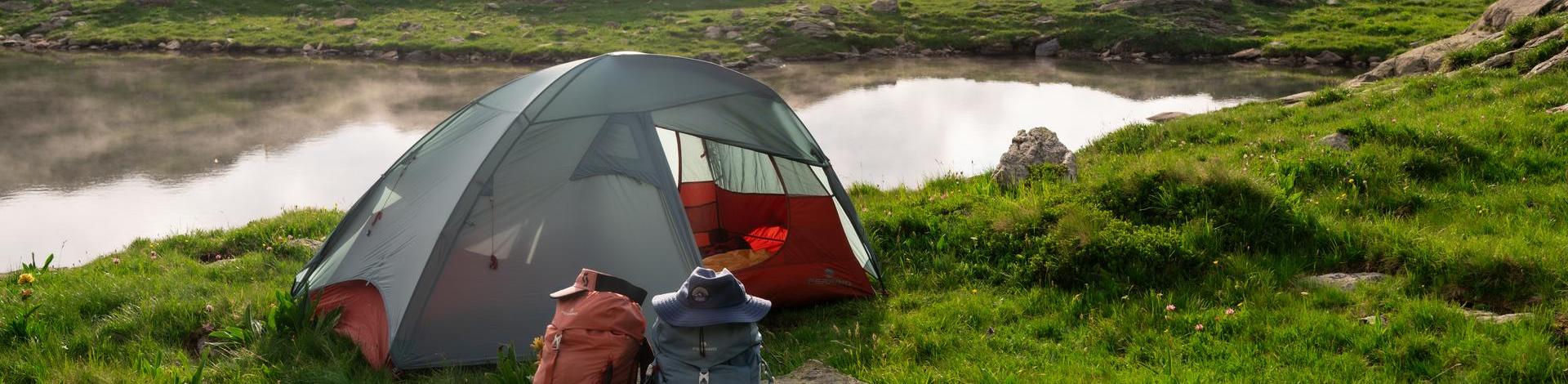
Responsible Camping: If camping, choose designated spots near refuges to minimize your environmental impact.
Other Useful Tips
Reservations: Book your stays in refuges in advance, especially during peak season, to secure your accommodation.
Safety: Inform someone of your itinerary and expected schedule. Always have an emergency communication device, such as a mobile phone or a backup GPS.
Hydration and Nutrition: Drink water regularly and eat energy-boosting foods to maintain your strength and endurance.
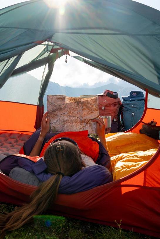
Knowledge of the Route: Study your route in advance and carry a physical map in case your GPS or phone fails.
Enjoy this exceptional 6-day trek in Les 3 Vallées, where each stage offers its share of discoveries and emotions!
Les 3 Vallées
UniqueEscapes
Embark on a sensory journey to the heart of the 3 Vallées, where each season unveils a palette of new treasures. From the spring awakening of the alpine meadows to the summer delights of sunlit lakes, and through the vibrant colors of autumn, let yourself be enchanted by unique experiences.
-
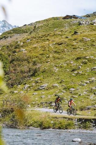
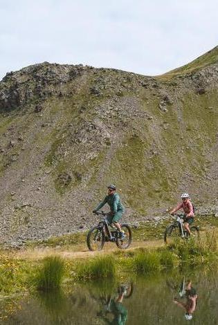
Explore on bike - For all
Electric Mountain bike Bivouac at the Jean Pass: A Family Adventure in the Heart of the French AlpsBivouac and breathtaking panoramas at the Jean Pass
-
Summer & Fall activities - For all
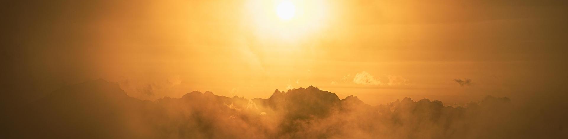
The most beautiful sunsetsWhen the sun sets
-
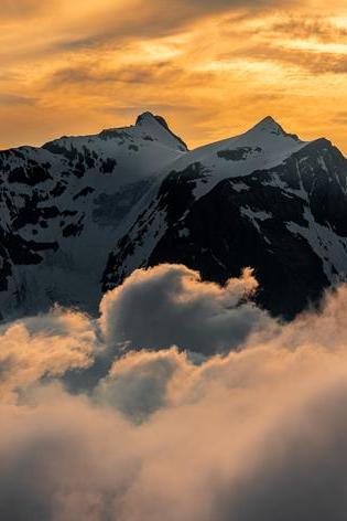
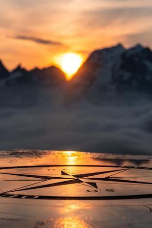
Unique adventures - For all
Our breathtaking panoramasAdmire and breathe
-
Family friendly - For all
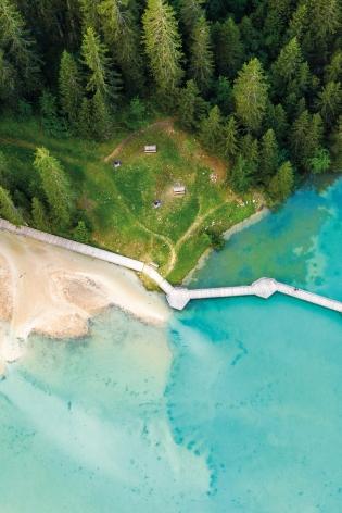
Natural and artificial lakes in Les 3 Vallées for familiesRecharge & relax
-
Explore on bike - For all
Three days of mountain biking dreams in Les 3 ValléesAlpine escape by electric mountain bike